Shark Dive
July 17
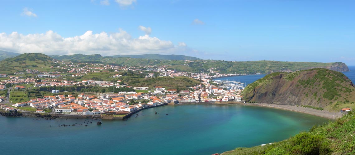
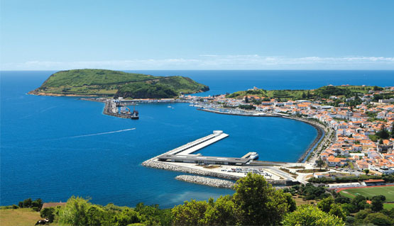
The island of Faial is located at the western end of the Central Group of the Azores archipelago, separated from pico island by a channel of 8.3 km. Always known for its strong relationship with the ocean, it is a mandatory stopping point for sailors and lovers of the sea and diving.
Island that embraces who arrives
and just lets leave with desire.
All nine islands from the Azores are volcanic and located between 37° e 40° North and 25° e 31° West, being the most western part of the european continent in Flores Island. 244 780 persons live there (2008 data). It stays 1 815 km from Europe (Portugal) and 2 625 km from north-america (Canadá).
The islands of the archipelago were divided into three geographical groups: the Eastern Group, composed of Santa Maria and São Miguel, the Central Group includes the islands of Terceira, Graciosa, São Jorge, Pico and Faial and the Western Group constituted by the islands Corvo and Flores.
The Azores has a maritime climate with mild temperatures ranging from 16 º C (60 º F) in winter to 26 º C (79 º F) in summer Sea temperatures are influenced by the Gulf Stream, and they too mild and between 14 º C and 22 º C in average.
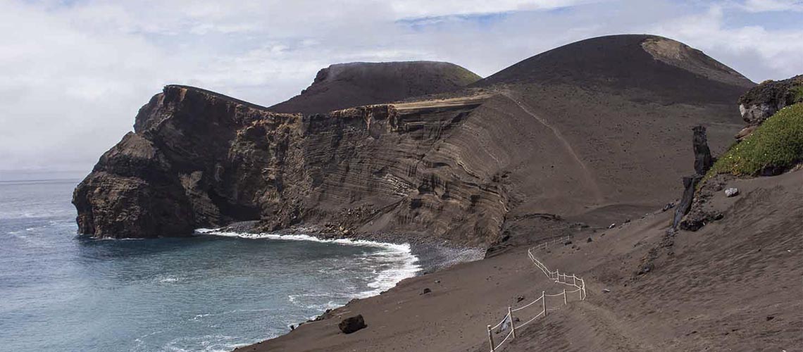
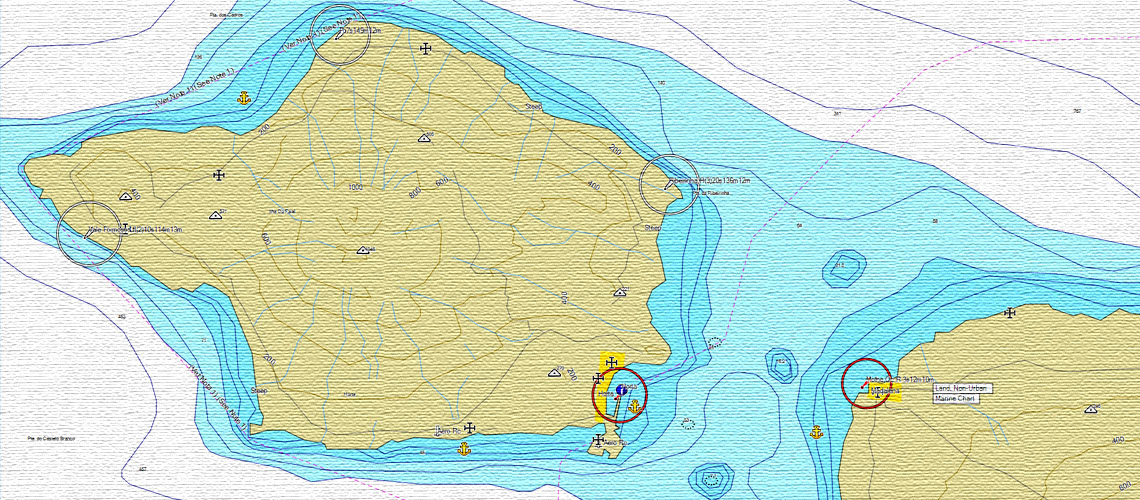
Faial island is the farmost ocidental island of the central group of islands in the Azores, separated from Pico island by a strait with the lenght of aproximately 4,5 nautical miles know as Faial channel. The island has the shape of an irregular pentagon beeing aproximately 21 km in length oriented east to west and arround 14 km width, making the island having an area of 172,43 km².
Due to its location you will only need light clothing with something warmer for the nights. It is recomended to bring some rainproof clothing because rain is failry frequent specialy in the months from October to April.
With arround 19,8 km in lenght e 14 km wide, the 173,43 Km2 of the Fail island area are pentagonly shaped. It is the third most inhabited island of the archipelago com 15.629 residents (2008 survey data). The Faial island is part of the central group of islands and it is the western vortice of the so called “Islands of the Triangle”, together with São Jorge and Pico islands beeing arround 3 nautical miles appart. The highest point in the island at 1043 meters is in Cobeço Gordo in Caldeira's area with the following coordinates, 38°34’34’’ north latitude and 28°42’47’’ west longitude.
Fail geological history comprises three great periods:
Pre Caldeira period, bellonging to this periodo is the vulcanic complex of Ribeirinha, datade in 800 ad a thousand years before the present beeing the oldest part of the island locate on its northeast region.
To the northwest we have the vulcanic complex of Cedros with about 580 thousand years old. To west and southwest of this region and according to the common trend of the island on the east side of mid atlantic rig of growing to the westfrom about 400,000 years ago until about 10 thousand years has been developing a gigantic volcanic cone, essentially consisting of lava spills resulting from a predominantly effusive eruptive activity. a result of this mass and the presence of Fracture Faial-Pico.
There are about 50,000 years settled on the east flank of the island an important tectonic and volcanic activity fissure, which gave rise called the Relief Failed East Coast. This training is a failed relief with lifting (horst) and sinking (graben) of large separated by nearly vertical cliffs blocks, punctuated by secondary cones installed on zones fracture.
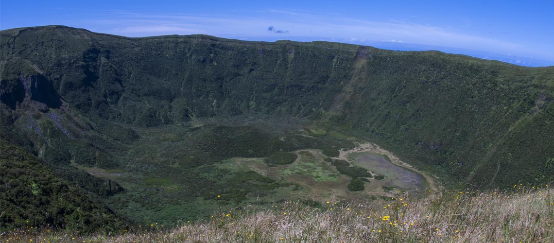
Caldeira (volcano crater) formation, 10 thousand years ago, there was a change in eruptive style of the central volcano, entering an almost exclusively explosive phase, which was responsible for the vast deposits of pumice and other pyroclastic materials which cover almost the entire island.
During this phase was the collapse of the upper part of the volcano, with subsidence of top of the magma chamber in the formation of the current volcano crater. The collapse appears to have occurred in two distinct episodes: the first took place on the mountaintop, developing into it, the second was originated by a violent eruption, with release of a fiery cloud.
The reduction of the volcano crater will have occurred at the same time or immediately after this eruption, which recovered more than 40 % of the island's surface with a thick layer of pyroclastic materials, more to the north and east of the eruptive center. Most of the vegetation cover, if not the whole, was destroyed.
The eruption was accompanied by powerful floods that resulted from heavy rainfall induced by the condensation of dust around Volcanic dust present in the atmosphere, over a steep slope characterized by the inconsistency of the soil. On the cliffs of Praia do Norte are traces of these mass movements.
Post Caldeira (volcano crater) formation The previous period resulted in the Caldeira (volcano crater) formation, consisting of the accumulation of Projection materials - pumice and ash - reaching remarkable thickness near the edge of the crater, becoming gradually thinner as we move away from the boiler.
The formation, perhaps due to his youth, has shown relative stability, although their east and north slope, show obvious signs of multiple landslides, some of which (like the one resulted from the earthquake of July 9, 1998) incurred after the settlement of the island. The interior of the volcano crater keeps active volcanism, as witness the eruption with lava effusion inside, which occurred about a thousand years, and activity - patent during the volcanic eruption of the volcano Capelinhos in 1957-1958.
Although it is not known the age of the small cone on the interior, it is associated with the volcanic complex of Capelo, according to the description Gaspar Fructuoso (1570-1580), the caldeira remained almost identical up to the eruption of Capelinhos, when, during the seismic crisis of May 1958, opened cracks inside that broke the bottom sealing the volcano crater.
This led to the flow of water from small existing lakes within the central cone, triggering violent phreatic explosions and the occurrence of fumarolic temporary activity. As a result of the earthquake of 9 July 1998, there were several landslides on the almost vertical crater walls. Also belonging to this period is formation of the volcanic complex of Capelo, dated about 5000 years ago, the result of a volcanic activity major fissure along a line which produced an alignment of vulcanic cones.
In that region, west of the volcano crater, there were two historic eruptions that destroyed the parishes of Capelo and Praia do Norte: The Cabeço de Fogo eruption in 1672-1673 and the eruption in Ponta dos Capelinhos in 1957-1958, this one accompanied by the appearance of fumaroles at the bottom of the volcano crater in May 1958.
During the twentieth century, the island recorded strong earthquakes on August 31 1926, on May 13 1958 ( associated with the eruption of Capelinhos), on November 23 1973 and on July 9 1998.
Information collected by fishermen point to the occurrence of an underwater volcanic eruption on July 22 2007, a segment near the Crest Middle-Atlantic, about 180 miles southwest of Ponta da Capelinhos in Faial. The event was detected from sonar on ships, having on occasion some recovered underwater cables showed exposure to high temperatures.
The Center for Volcanology and Geological Risk Assessment of the Azores, in conjunction with the Department of Oceanography and Fisheries of the University of Azores, reported that this event was not accompanied by any seismic activity recorded at stations of the archipelago, as a result of the low magnitude of the events, which are usually associated with these phenomena and great distance to the episode epicenter.
It is assumed that the Portuguese discovery of the island has occurred after mapping the Terceira island. It's name have been inspired by the abundance of beech tree's found. The first official settlers, Flemish and Portuguese in origin, should have reached around 1465 performing a first expedition in search of tin and silver beeing nevertheless unsuccessful.
Two years later, the Flemish nobleman Josse Van Huertere returns to Faial and, attracted by the fertility of the soil, becomes captain Portuguese donee in 1468. Under Royal Warrant of King Afonso V he brings new settlers from Flanders to inhabit the Valley of the Flemings before settling in Horta city.
Foreigners introduce the cultivation of glastum on the island. Exports of wheat and dye plant represent for more than two centuries the foundations of Faial economy. The Spanish occupation in 1583 and the attacks of corsairs, mainly French and English, mark a period of misappropriation of assets and wealth of the island. The volcanic eruption of 1672-1673 also causes high destruction in the northwestern part of the island.
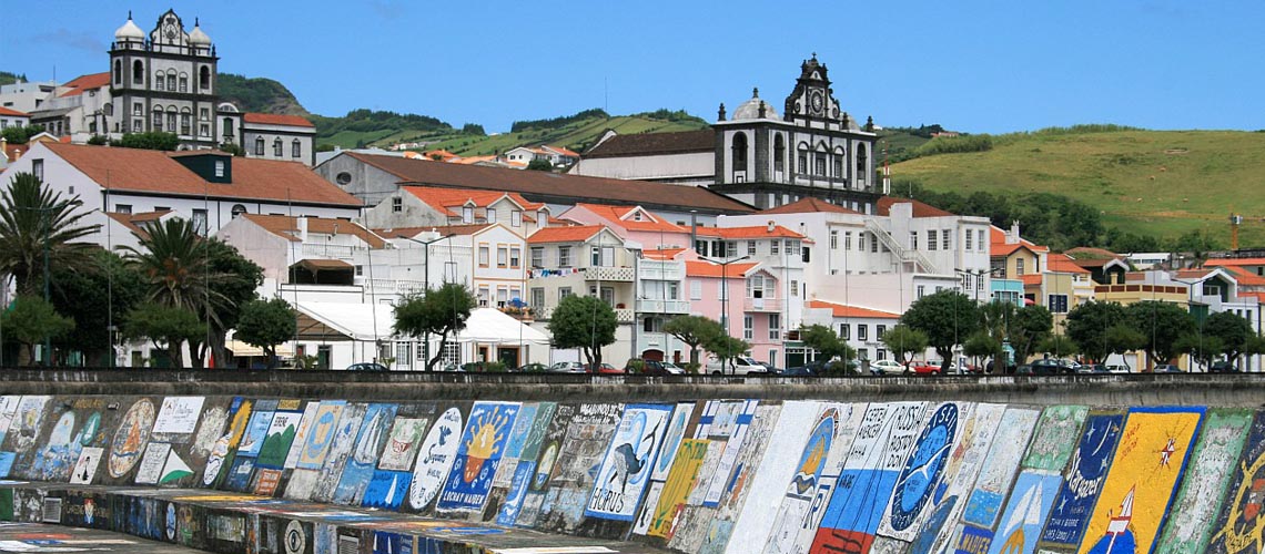
The boom of the seventeenth century after the Restoration, comes in the form of safe haven. Horta becomes a stop point for navigation between Europe and the Americas, due to the conditions of its bay and the increase of wine export produced on the island of Pico. This along with the wine and brandy from grapes originating from São Jorge and Graciosa, is marketed to Europe and the British colonies. In the eighteenth century, the island also participates in the cycle of production and export of oranges, source for the enrichment of the archipelago. The port of Horta experiencing a golden age, serving as a scale to supply the steam ships cross the Atlantic and the North American whaling fleet.
In the mid-nineteenth century, weeds diseases decimated vineyards and orange groves in the space of a decade. But thanks to its location the island becomes a telecommunication center. The transmission of information between North America and Europe is effected by underwater telegraph cables tied in Horta, whose inaugural network dates back to 1893. Subsequently, several International companies install submarine cables that connect continents passing the island. Similarly, the Azores gain size early in the twentieth century with the completion of construction of the Meteorological Observatory at Horta in 1915.
Aviation also takes the privileged position of Faial, the first seaplane scale crossing the North Atlantic, the first passing by Horta shortly after the end of World War I in 1919. in the decades of 1930s and 1940s, the major German companies, British, French and American aviation choose the island as a place of anchoring for the respective seaplanes.
The advantage of this boon due to the geographical conditions remained until today. The marina of Horta, inaugurated in 1986 is one of the most famous ports under the world. With the establishment of the autonomic model, Horta became the seat of the Regional Parliament of the Azores and accompanied the regional economic change, developing the tertiary sector, to the detriment of the other sectors.
At present we can not say that there is endemic in the Azores, that means no known species originate in the archipelago. However, some species that have been introduced in the Azores, with the passage of time, they developed a unique and native, especially in terms of color and size, so they are specific subspecies from the archipelago.
Being located in an optimal position for many migratory birds flying from north to south, from east to west on the planet, across the Atlantic, the importance of the Azores for these birds is vital for his rest, nesting and reproduction. Many nest are built on the cliffs by the sea, in the islets, in ponds or even in the most remote areas of the interior of the islands. Priolo, a little bird that once was thought extinct, was be rediscovered in the wild in the Azores and is now a protected species.
Among the species of birds that have adapted well to the archipelago is also the kite, the crow, the canary, the terrain, the dove-of-the-rock, wood pigeon, the shearwater, Tern... The dwarf Ferret, ferret, hedgehog and rabbit, all are wild species of mammals quite common here, the last considered is accepted as sport hunting. Already in freshwater rivers and lakes is normal to find some species of trout brown trout on rainbow trout, perch-likes, carp and pikes.
These species not only enter in fishing activities,they also are in the menu of the restaurants on the culinary trail a species that deserves special mention among those optimally adapted to the particular conditions of the Azores is precisely the line of the dog, Cão de Fila, which is now a watch dog breed recognized nationally and internationally. It is a very intelligent dog, loyal, tenacious and hardworking, whose main function has been traditionally cattle guard and protect the islands. They are a breed approved by the Kennel Club of Portugal since 1984.
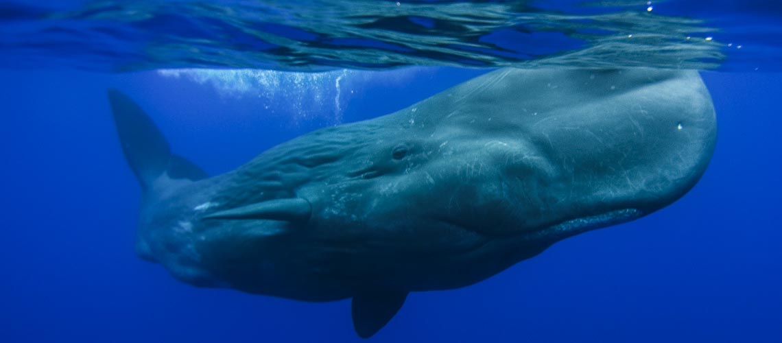
But it is the sea that it lies the greatest wealth of the Azores with the abundance of hundreds of species of molluscs and fish and large mammals such as whale and dolphin.
In the archipelago can be found about 60 endemic species of plants, shrubs and trees, taking into account that specific conditions, all are derivations of the species that were introduced in to the area.
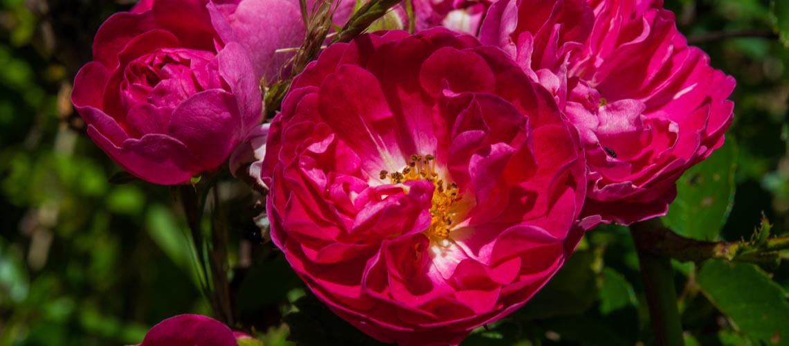
These include the Bay, the Queiró, Heather and Cedar. For more information, about 700 species have been introduced to the islands over the centuries, whether for commercial purposes or for decoration / aesthetics. The island's mild climate means that many of these species, which normally would have great difficulty surviving in other regions, here are developed with unusual vigor.
To add a special charm to the islands we can find some flowers, such as hydrangeas, camellias, azaleas or used as natural divisions of the properties, such as windbreaks or just for border roads. Even in the most remote areas of the vegetation of this part of the Macaronesia lends to its unique landscape beauty. The Mahogany Laurel, the Sanguinho among others are part of this group of rich vegetation.
The Cedars, which in many parts of the world are but a bush, in the Azores become large timber trees sold. Others, such as acacia or Cryptomeria, introduced in the archipelago of little more than a century has also gained importance over time.
In Faial the diving season is only from June to October, due to adverse weather conditions in winter, fall and early spring.
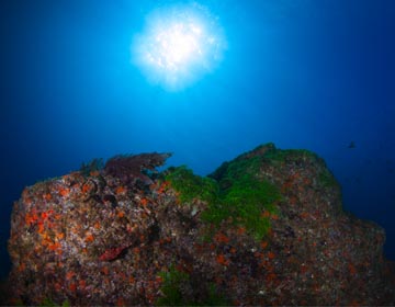
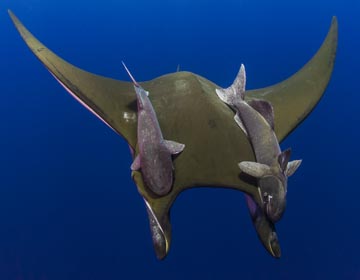
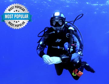
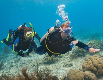
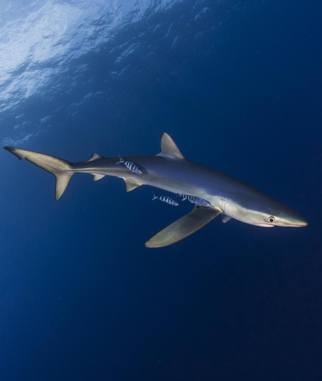
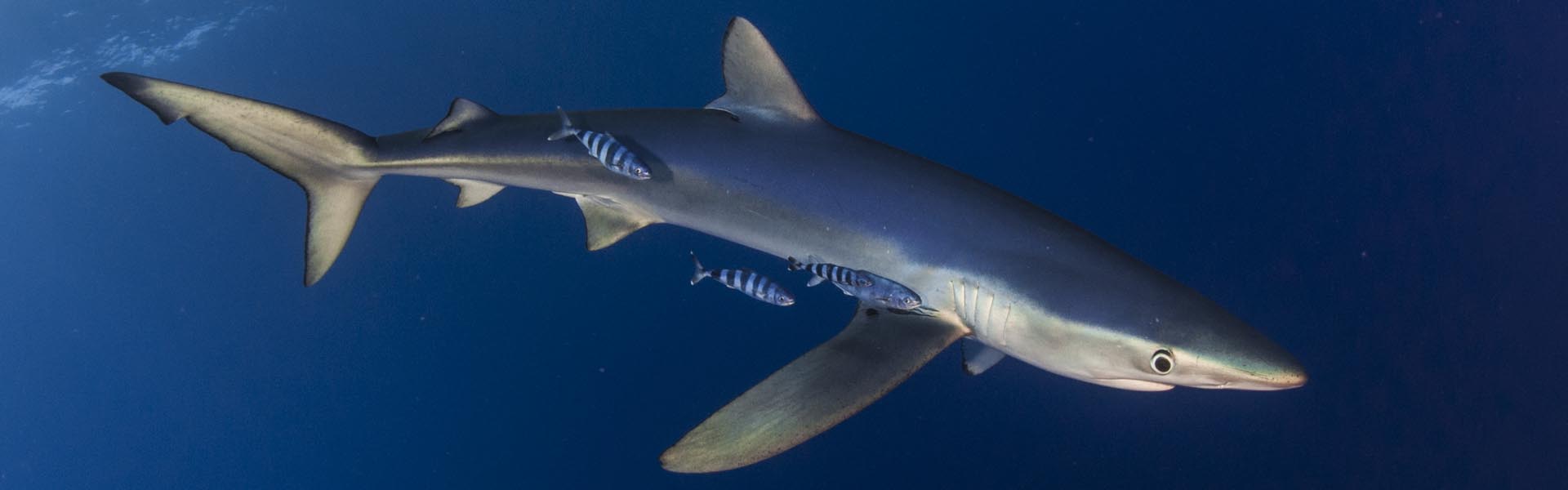
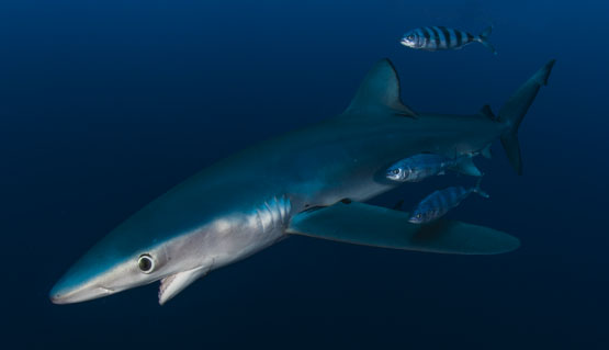
The dive on the island of Faial offers very easy dives with lots of life, small caves and some shipwrecks, with the highlights being the dive on the Princess Alice bank, where the sighting of mantas is regular, and the shark dives where the blue shark can be seen.
In the dives next to the island, the water temperature varies between 18ºC and 21ºC and the visibility between 10 and 20 meters. On more remote dives, such as Princess Alice, visibility reaches up to 40 meters and the water temperature can reach 24ºC. A 5mm or 7mm suit is recommended.
The dives are made in semirigid boats and sometimes the trips are long. Normally, we do not return to the boarding dock between dives, the surface interval being carried on board. To get to the bank Princess Alice the trip is about two and a half hours.
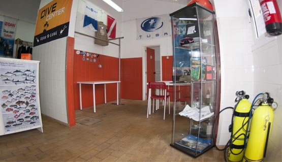
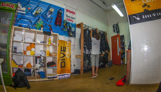
One of the most complete diving shops.

Know the characteristics

Know our roots.
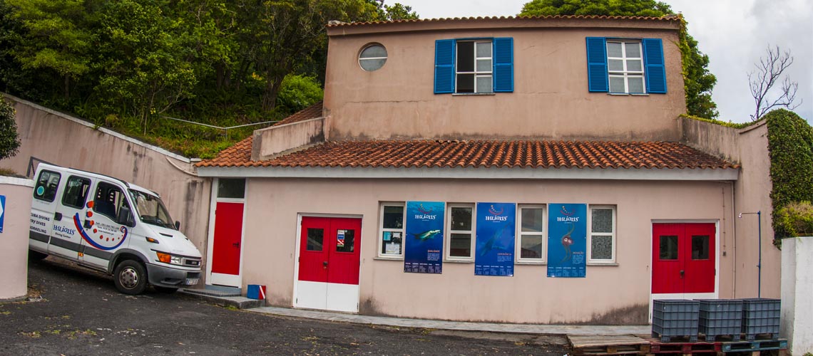
The exceptional conditions of the location of the Azores be it on the climate level or by the influence of ocean currents that provide unique diving conditions making it possible on the same dive observe several species of wildlife and underwater flora. This time Haliotis created another project a Dive Center in the Faial Island of the Azores, where you'll find the largest Dive Center in Faial.
Underwater fauna is breathtaking. Large groups of manta rays, jackfish and tunas are common when diving in open waters. There also emblematic encounters with large grupers and constant the presence of moray eels, and you may see schools of colorful fishes. The Azores are undoubtedly one of the best places for diving in Europe. We have dive sites to suit all tastes and levels of experience, such as the iconic Princess Alice Bank, Bank of Condor and low Canal between Faial and Pico, among many others.
With arround 19,8 km in lenght e 14 km wide, the 173,43 Km2 of the Fail island area are pentagonly shaped. It is the third most inhabited island of the archipelago com 15.629 residents (2008 survey data). The Faial island is part of the central group of islands and it is the western vortice of the so called “Islands of the Triangle”, together with São Jorge and Pico islands beeing arround 3 nautical miles appart. The highest point in the island at 1043 meters is in Cobeço Gordo in Caldeira's area with the following coordinates, 38°34’34’’ north latitude and 28°42’47’’ west longitude.
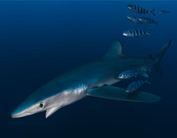
The fish adopted as the mascot of Haliotis in Faial is the blue shark (Prionace glauca). It is the most abundant shark species in the world beeing an ocean dweler it may also occur in coastal areas. These come in greater abundance with water temperatures varying between 13 and 18 ° C. Have elongated body with long, conical snout. Their eyes are large and round. The first Dorsalfin is low has a and rounded vertex. The pectoral have the shape of a sickle and are narrow and long. The dorsal coloration is bright blue with lighter blueflanks and off-white belly. This species reaches 4 m long and 205 kg in weight.
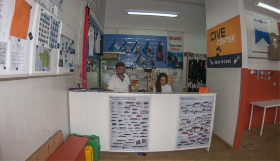
Meet the members of our team, who work daily to provide the best underwater experiences.
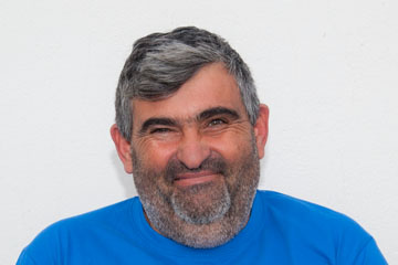
Luis Ferreira
Divemaster luis.ferreira@haliotis.pt
Tel. +351 911 913 624
e-mail: faial@haliotis.pt


Licenced by Instituto de Desporto de Portugal
All insurance by Mútua dos Pescadores
Operator Maritimo Turistico with licence Nº17 by Capitania do Porto de Peniche
Tourism licence 9/2009

Company registered in RNAAT with activities recognized as Nature Tourism

Licened by Instituto da conservação da Natureza
Company registered in RNAAT with activities recognized as Nature Tourism